
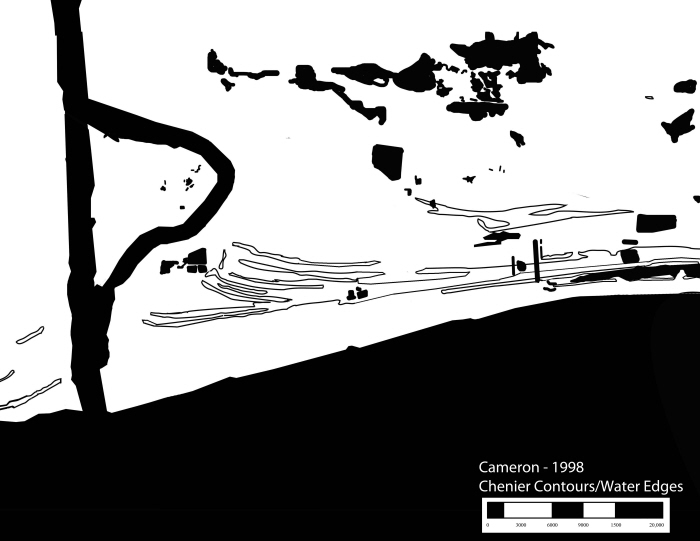
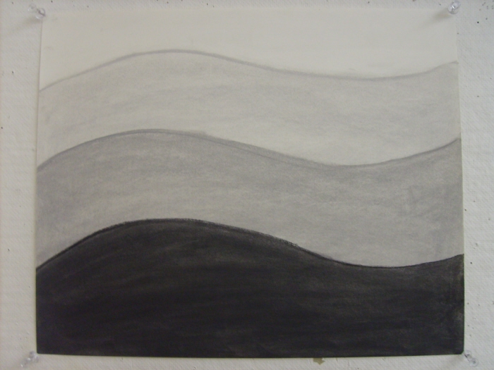
Cameron_Cheniers/Water_1935
Cameron_Cheniers/Water_1998
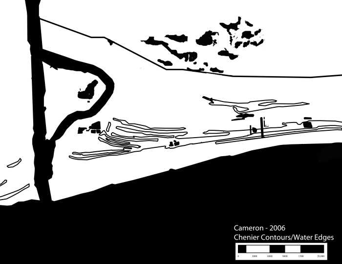
Cameron_Cheniers/Water_2006
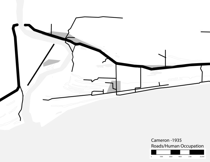
Cameron_Roads/Human Occupation_1935
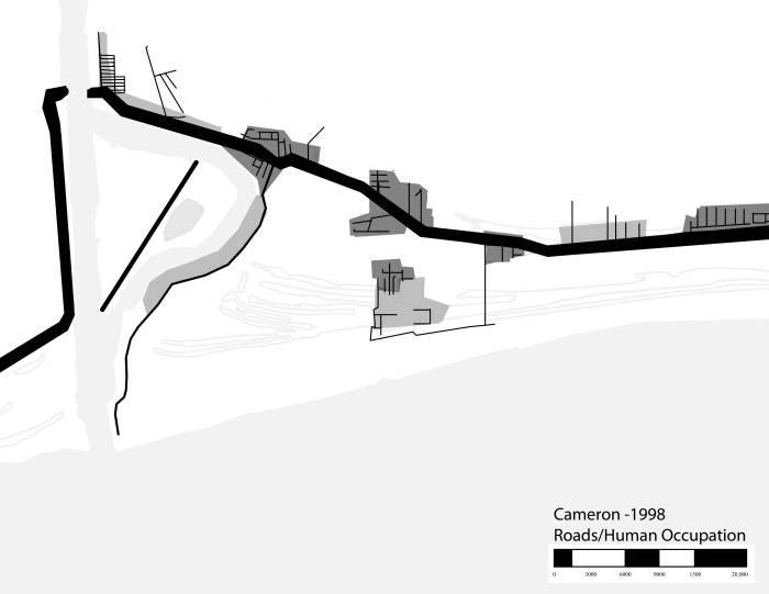
Cameron_Roads/Human Occupation_1998
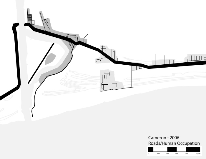
Cameron_Roads/HumanOccupation_2006
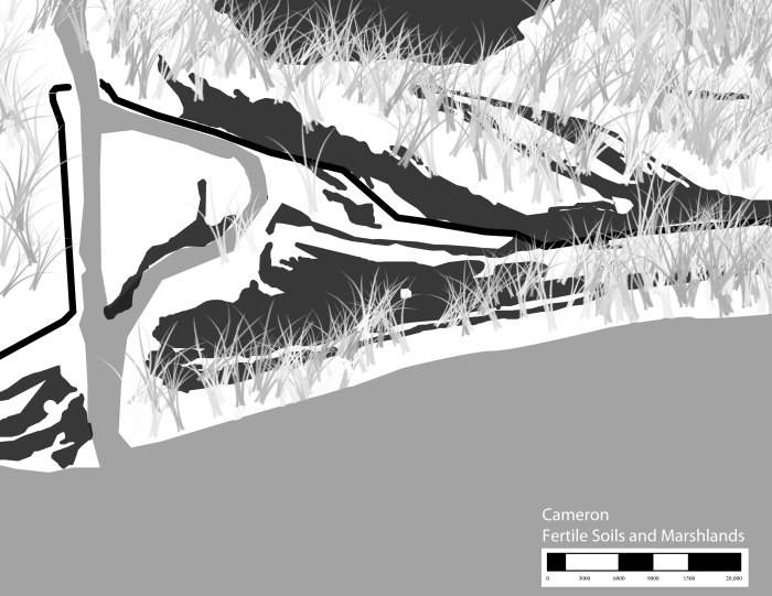
Cameron_RichSoils/Marshland
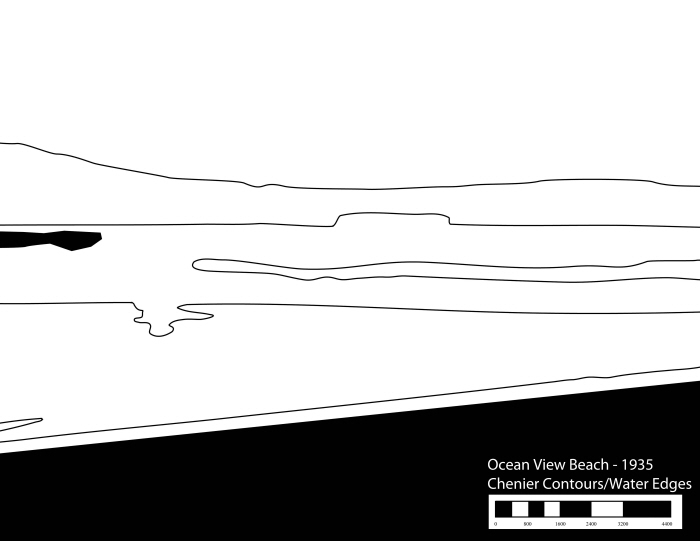
OceanViewBeach_Cheniers/Water_1935
OceanViewBeach_Cheniers/Water_1998
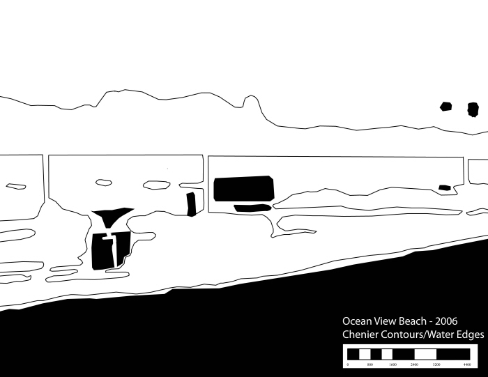
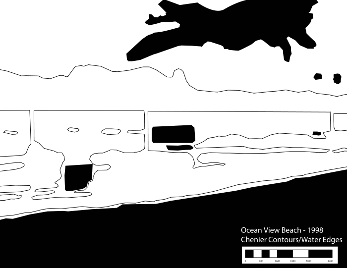
OceanViewBeach_Cheniers/Water_2006
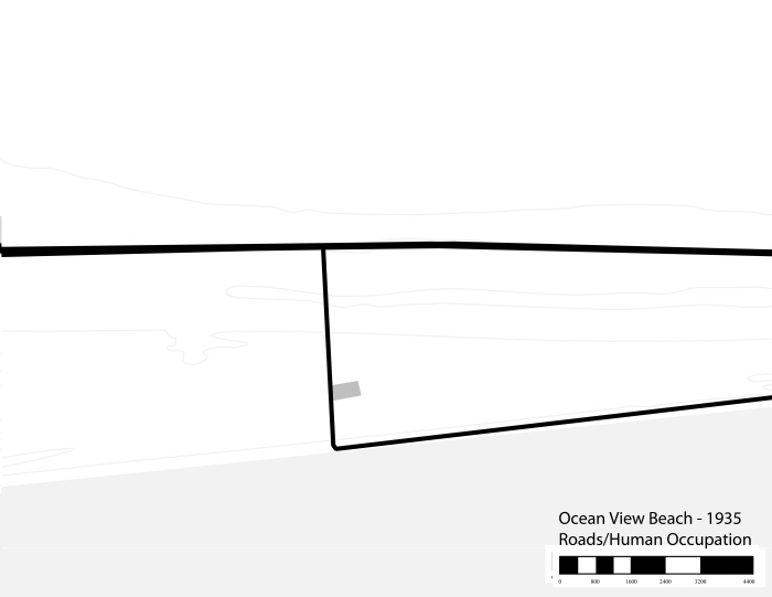
OceanViewBeach_Roads/HumanOccupation_1935
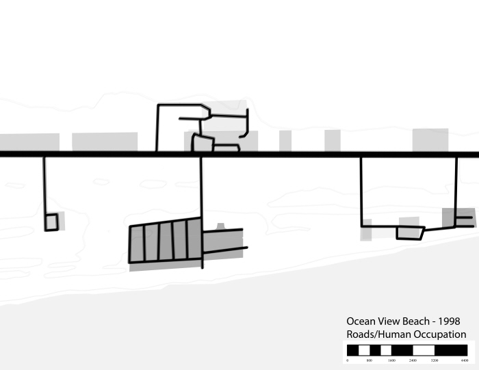
OceanViewBeach_Roads/HumanOccupation_1998
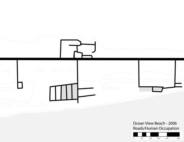
OceanViewBeach_Roads/HumanOccupation_2006
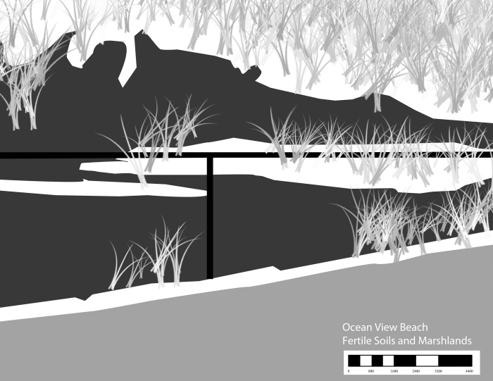
OceanViewBeach_RichSoils/Marshland
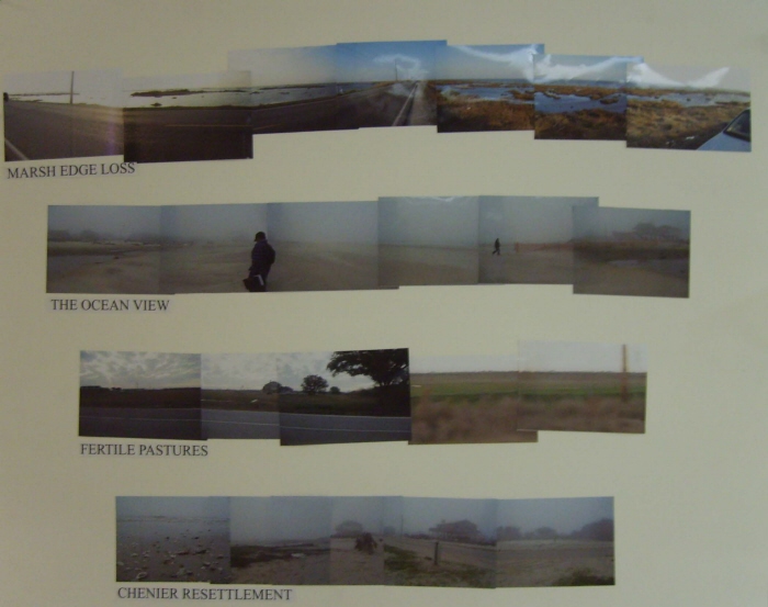
Cameron Parish Panoramas_marshedgeloss/oceanviewchenierrestoration/newhomes/fertilepastures
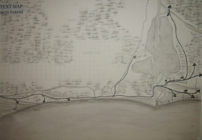
Context Map_marshland/cattleslavetravel/hunting/waterbodies/Creoletrail
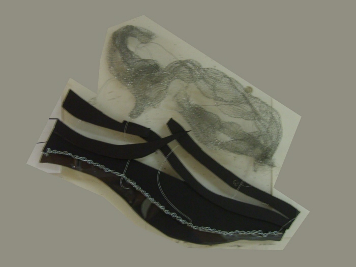
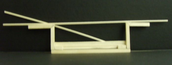
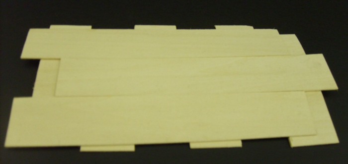
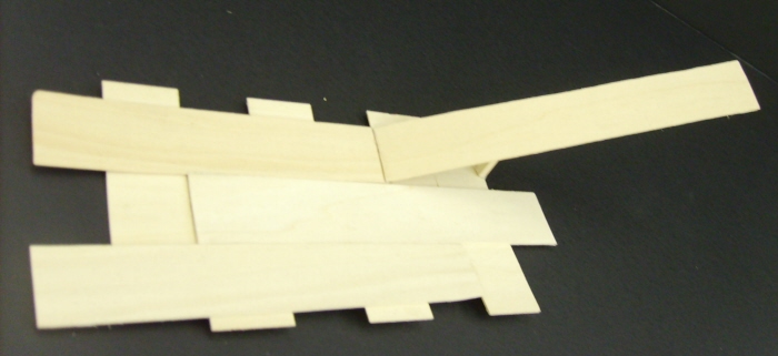
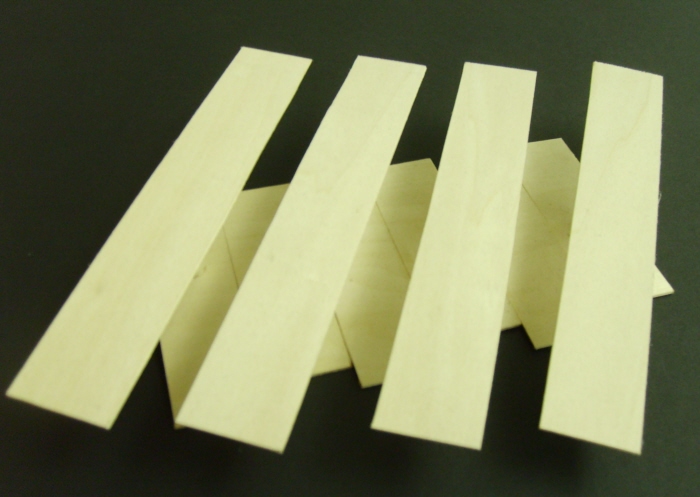
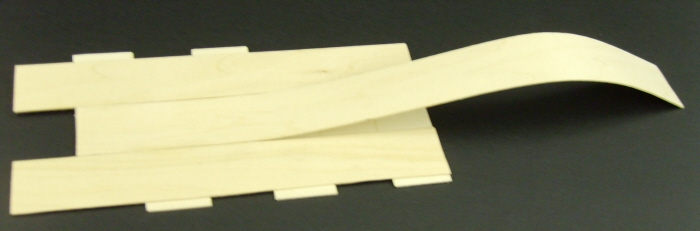
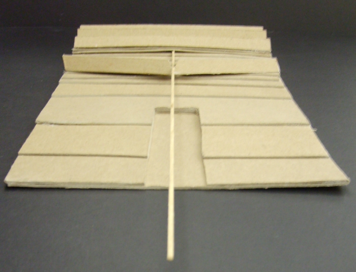
Studymodel
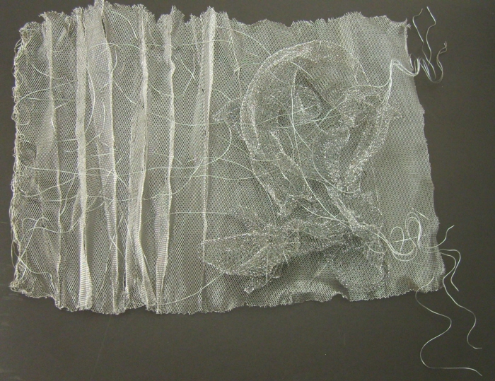
Model_Marsh/Chenier/Culturalconnections
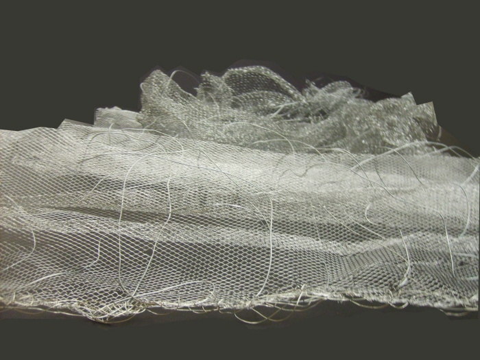
Model_spacialview
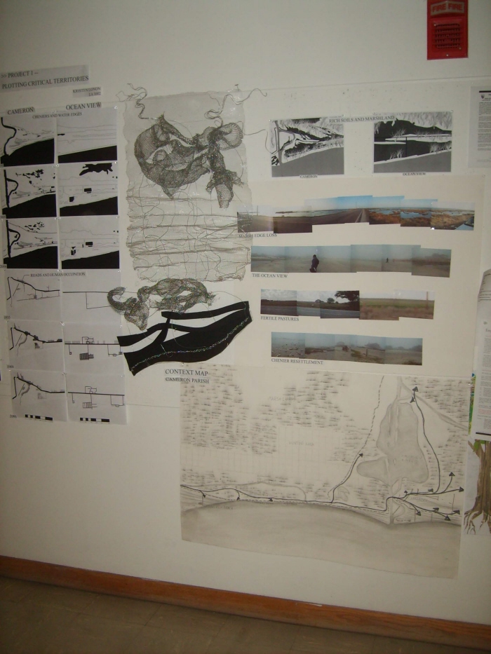
Display
prelim_model_hopper
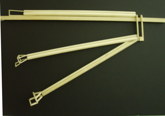
prelim_model_lowering of arm
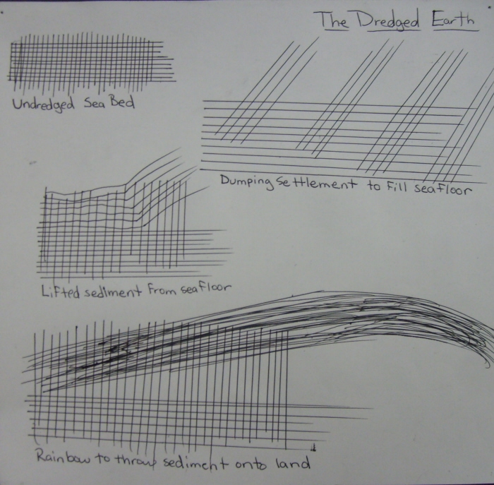
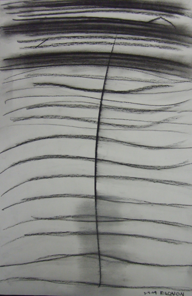
speculation_effectonearth_planesmodelidea_drawing
planesmodel_undredgedearth
planesmodel_dredging of earth
planesmodel_bottomdump
planesmodel_rainbowdump
prelim-redone dredge model - This is the redone version of my dredge model. I improved my craft and kept the size consistant throughout the model. The complete model has duckwings attached to it as well.
abstractdrawing of dredge model
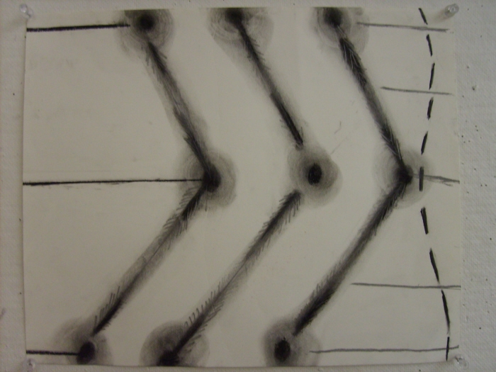
prelim_3step-diagram-chenierbuild - This is a diagram of how dredged material stacks upon itself. The darkest values happen first; the lightest last. For an area about the size of the Ocean View Beach neighborhood, each level, about 2 feet high would take about 2 weeks to dredge and 2 weeks to dump. The same goes for each of the other two levels, making a 6ft. ridge constructed in a little over a month. (That only goes for simple dumping, not including other forms of chenier maintenance).
prelim_3step-plan-chenier build - This plan view of the coast shows how the cheniers will be created. The darkest values happen first; the lightest last. The sediment will be rainbowed from the TSHDs to adjacent locations along the coast. The amphibious dredgers will carry the sediment from the coast and move the sediment along existing high contours. These ridges will be constructed one after another by spreading the sediment from location to location. The ridge closest to the coast will be constructed last.
prelim-3step-plan-duckwingbuild - This plan view of the coast shows how the duckwing terraces will be created. The darkest values happen first; the lightest last. The sediment will be rainbowed from the TSHDs where the assumed joints of the duckwing terraces will be. The amphibious dredgers will move from the Larger dredgers and from land to move the sediment inward to create the actual shape of the terraces until construction is complete.
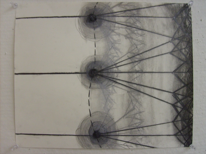
prelim- new lines model sketch - This is a diagram of a new lines model. It is a plan view of the motion the amphibious dredgers take as they construct new cheniers and duckwing terraces. There would be several of these machines working along the coast. A larger, high knoted, deeper sea amphibious dredger is pre-attatched to the ship for awkaward situations farther out in sea that the smaller, faster dredgers cannot access.
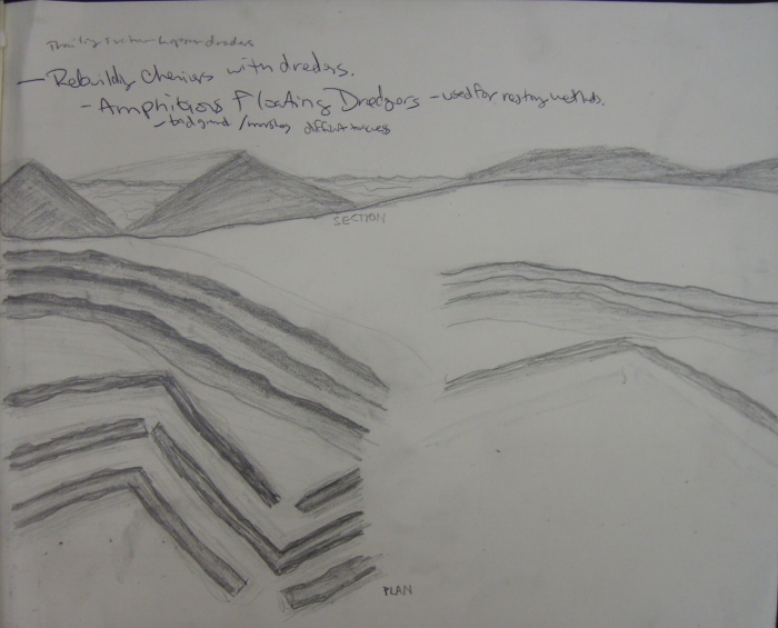
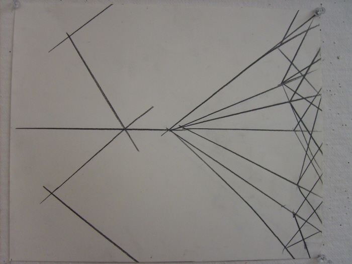
prelim_plan/section sketches
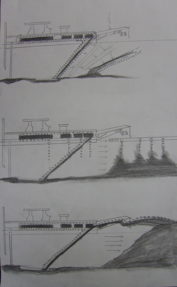
prelim_dredging systems
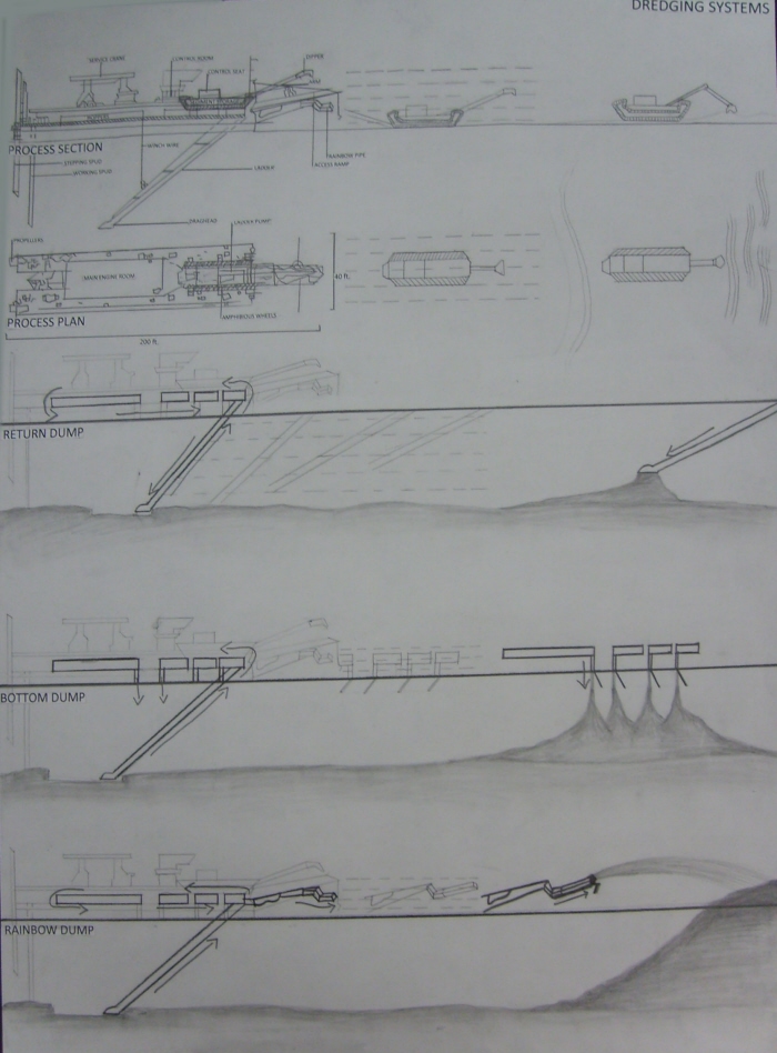
final_photographed_dredgingsystems
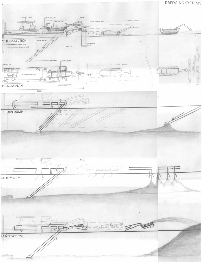
final_scanned_dredgingsystems
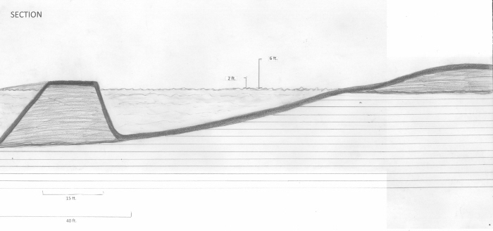
final_coastalsecttion
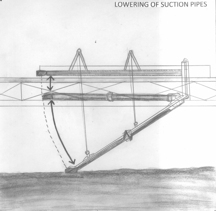
final_detaildrawing_armlowering
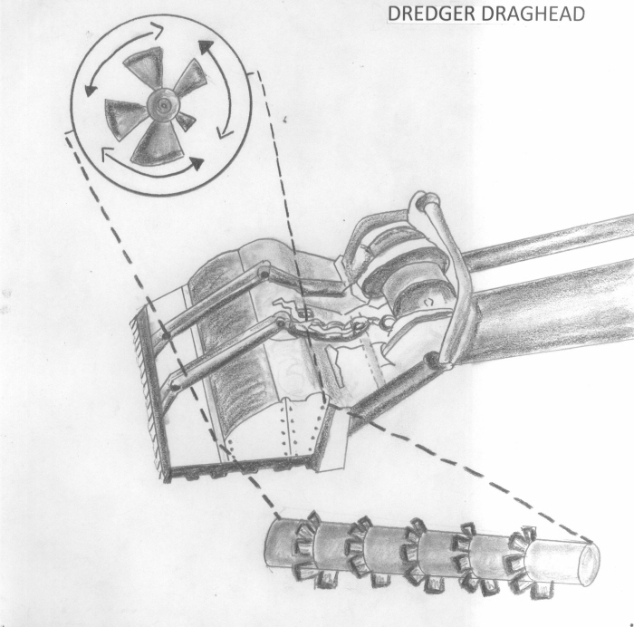
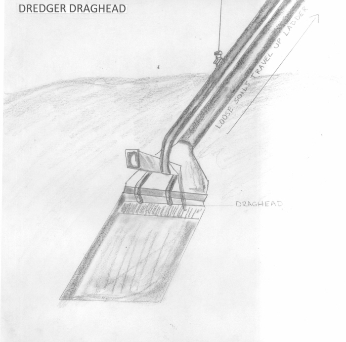
final_detaildrawing_draghead
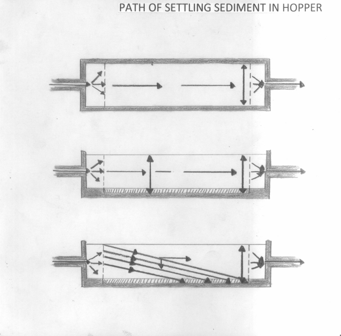
final_detaildrawing_hoppertanks
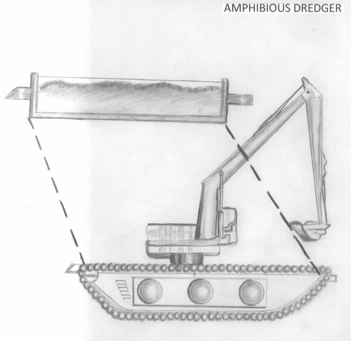
final_detaildrawing_amphibiousdredger
final_perspective_dredge
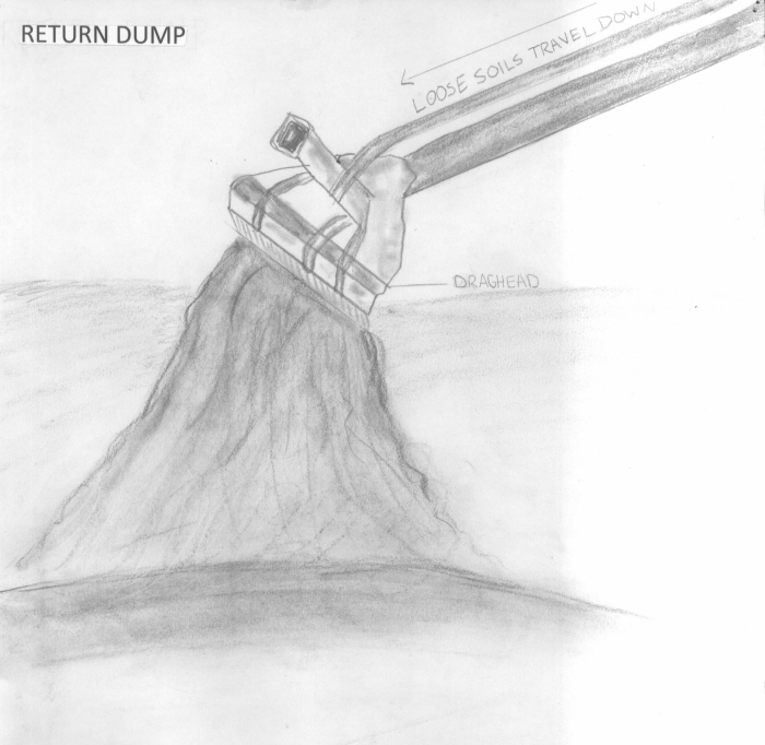
final_perspective_returndump
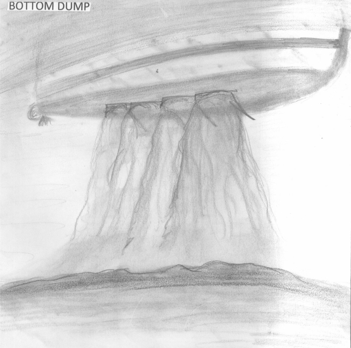
final_perspective_bottomdump
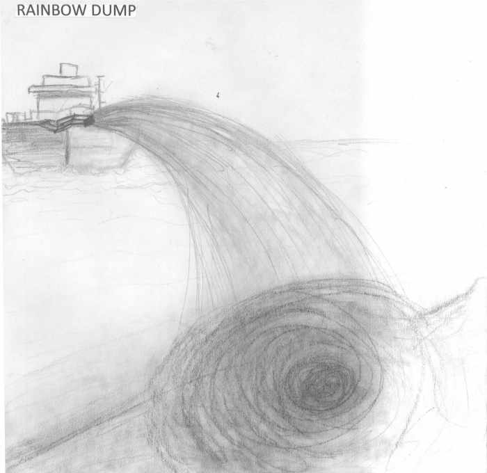
final_perspective_rainbowdump
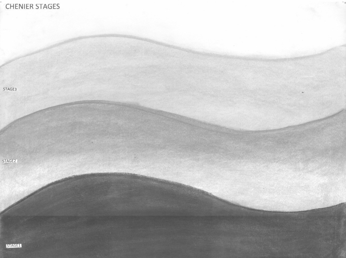
final_chenier stages
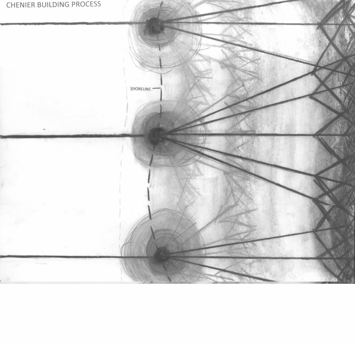
final_chenier building
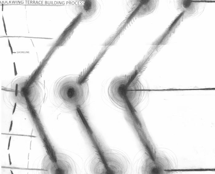
final_duckwingterrace building
final_sideview_machine functions
final_aerialview_machine functions
final_detailview_machine functions
final_line model

final_terrace model top
final_terrace model front

presentation layout

Machine Functions Diagram - This diagram was done to magnify the specific functions of my machine. Understanding the set of rules for this machine helps one to know how diverse it actually is in land building.

Machine Movement Diagram_Phase 1 - This diagram shows the ideal placement of both the Trailing Suction Hopper Dredger and the Amphibious Dredger along the coast waiting to being the project.

Machine Movement Diagram_Phase 2 - This diagram shows the inland path of the dedgers around the site. It maps where excavations and additions are taking place to create new landforms.

Machine Movement Diagram_Phase 3 - This diagram shows the coastal path of the machines along the littoral and gulf. Here, the breakwaters and additional land is being added to add protection to the coast. The inland ridges are complete by this time.

Machine Movement Diagram_Phase 4 - This diagram shows the ending land additions both on the coast and inland. The machines are in their stationary positions for seasonal maintenance of landforms.

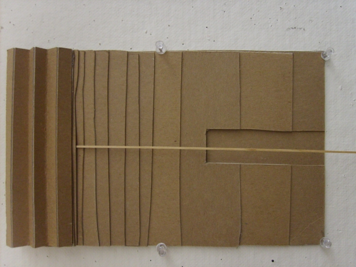
Phases of Machine Movement Model - This model shows in 3-D the 4 stages of machine movement used to create landforms. The steps are separated by size, Largest sizes being first steps. Once can begin to see the actual shape of landforms through the simple movement of these diverse machines; Amphibious Dredgers.

Concpet Model_Agriculture to Ridge Relationship - This study model shows my original idea of having lowland agriculture and higher landforms intertwine together like fingers on the landscape. I wanted the landforms to tie in and work simultaneously with the culture of the site.

Inland and Coastal Section Elevations - These 8 section elevations show the step by step machine movement phases. In section, these are able to show the actual look of the land and how that changes over the course of construction.

Ocean View Beach Redesign Site Plan - In this design, I aimed to keep the residents secure and close to their culture. I attempted to add more formal qualities to the design while still incorporating that crude, cultural aspect to the site. Residents, visitors, and wildlife can live in this fertile area. Many elements from their cultural and successful economic past are included in this design.

Hydrology Diagram_Hurricane Protection - This diagram shows in both plan view and section how this site is much more prepared to handle hurricane storm surge without the destruction of Inland structure.

Project Timeline - Because of the diversity of the Amphibious Dredger, small scale of Ocean View Beach, and site specific design, this project will not last more than 12 years. Outside of the actual machine's phases of landbuild, other factors must be taken into account to calculate project time.
By phase, there will be constant action on the site with one phase beginning before others end. There will be no unutilized time or space in this design with a tight plan.

Cultural Year - This diagram is quite relevant in displaying the history of this site and what industries kept them in economic success. There was a constant schedule of events for every month of the year and following this historic cultural activity played a large part in my design.

Seasonal Site Program_Winter - This shows in plan view what and where activities are prominent on the site during wintertime.

Seasonal Site Program_Spring - This shows in plan view what and where activities are prominent on the site during springtime.

Seaonal Site Program_Summer - This shows in plan view what and where activities are prominent on the site during summertime.

Seasonal Site Program_Fall - This shows in plan view what and where activities are prominent on the site during fall. The fairgrounds are more active around this time because of economic boom. Vendors and festivals are welcome during this time.

Maintanence Plan - Because this site's activity is so season based, so shall it's maintenance be. Using the Plan Program diagrams that separate the sites by seasonal activity, this plan can be used to relate and understand what areas need to be taken care of at a particular time.

Coastal Detail Section - This diagram shows the subsurface elements of the fairgrounds and how the newly added ridge soils relate the the existing beach soils. This diagram also shows how the new coast will be utilized.

Public Center Detail Section - This diagram shows the subsurface elements of the center and it's related elements like public parking and forestry. The deep penetration of the building into the chenier soils is shown. It's apparent in this section that the parking is well hidden by the forestry, allowing this area to be less disturbed by Highway 82.

Residential Area Detail Section - This diagram shows the subsurface elements of a home in relation to the backstreets and crop line. The home sits on the existing chenier soil and is not shown with 14' stilts because all relocated housing does not include this in my design. Insurance and stilts are safe but not as necessary in my new design. This section shows the adjacency of crops to home.

Pond House Detail Section - This diagram shows the subsurface elements of a pond house on the site in relation to a pond and it's surrounding elements like marsh grasses and decking. The pond house, like the center, is built with 14' stilts and sits on existing high chenier soils. This section shows the adjacency of Pond house to pond.

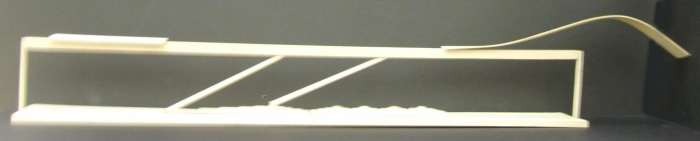
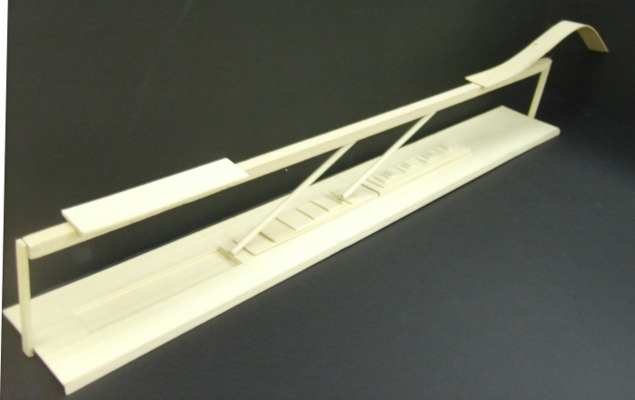
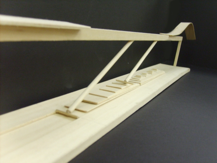
Journey From Human to Animal Habitat Model_Ariel View - This model shows man's journey on an open deck away from the safety of high chenier land, thought the wild sugarcane, past fencing, over marsh grasses, and into the alligator pen. In reality, this would be quite an experience though different landscape typographies with gradual, but dramatic changes.

Journey From Human to Animal Habitat Model_Side View - This model shows man's journey on an open deck away from the safety of high chenier land, thought the wild sugarcane, past fencing, over marsh grasses, and into the alligator pen. In reality, this would be quite an experience though different landscape typographies with gradual, but dramatic changes.

Alligator Pond House Axonometric - This axonometric shows a pond house in bird's eye view. Here you can see the relationship between animal habitat and human dwelling space, including entrance roads, parking and paths rising toward the edge of the fairgrounds ridge toward the coast. Wide open, beautiful spaces are defined by full grown Quercus virginiana and Celtis lavegata. The entire site includes plenty of space for seasonal festivities and marketing with minimal structure. These ideas are shown clearly here.

Highway 82 Site Approach Perspective - This perspective shows a visitor's journey to the site. The diversity of the new landscape is quite visible from the highway.

Center Entrance Perspective - This perspective shows travel of people from beach to the market located below the visitor center. This market well utilizes the space below the center, existing due to the 14' stilts it sits on. It also improves the aesthetics of the building and attracts more people, also, increasing economic conditions.
An Amphibious Dredger sits near a waterfowl pond.
gLike
Kristen Lonon