
The Mount Carmel Suburban Metamorphosis is designed assuming a future with high gas prices, lower car reliance, higher public transit services, increased land values at the downtown core, decreased land values on edge of the urban area, and a high senior population with low pensions. The metamorphosis employs sound city planning principles, landscape architectural design, and does so within the confines of an existing affluent 250 hectare suburb.
Credit: Background image by Gygrazok of deviantART.
View PDF
View PDF
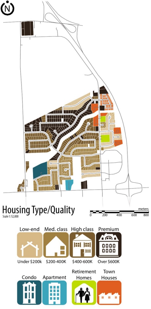
Inventory map showing the affluence levels and housing types in Mount Carmel
View PDF
View PDF
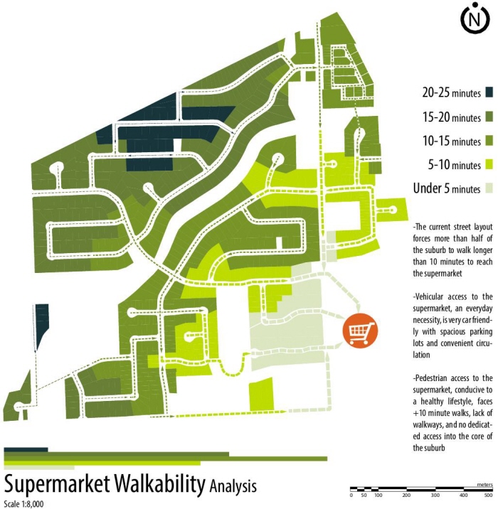
Analysis map of time required to walk to the local supermarket. Lighter colours represent shorter walks and darker colors show longer treks.
View PDF
View PDF
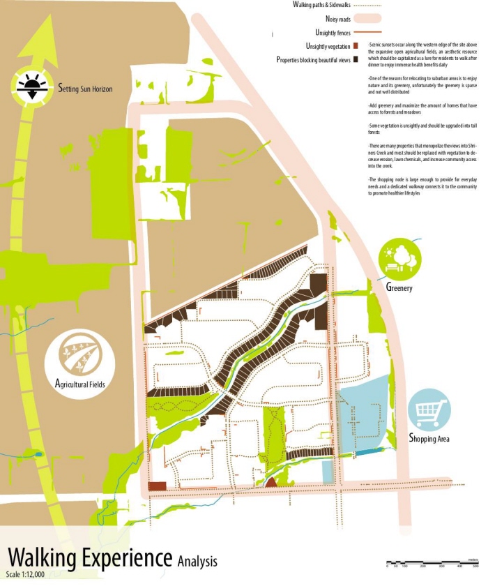
Analysis map showing various elements affecting the pedestrian walking experience. They include busy streets, homes blocking sight lines, aesthetic detractions, attractive vegetation, shopping venues, and scenic landscapes.
View PDF
View PDF
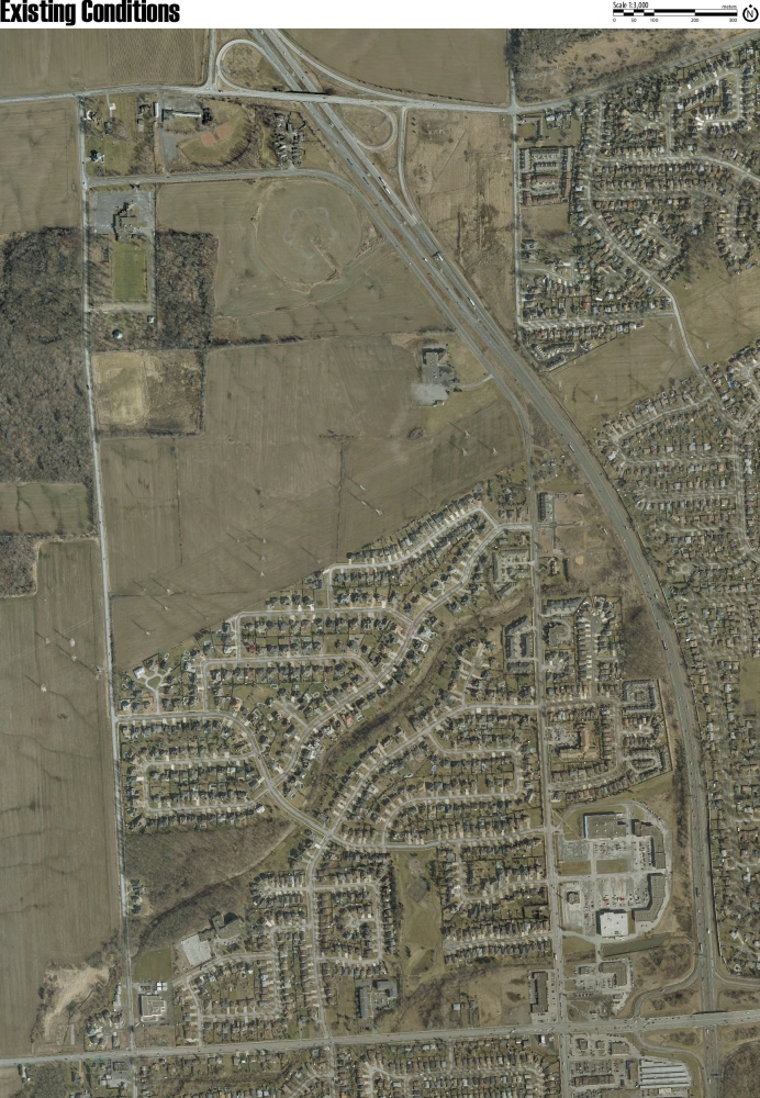
Aerial imagery of the Mount Carmel Subdivision (Niagara Peninsula Conservation Authority 2012)
View PDF
View PDF
Final stage of suburban metamorphosis
View PDF
View PDF
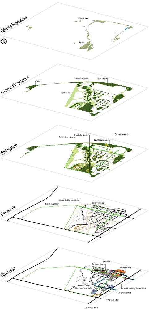
Isometric view of additional forest cover, a new trail system, dedicated pedestrian/bicycle path (greenwalk), and circulation within the suburb.
View PDF
View PDF
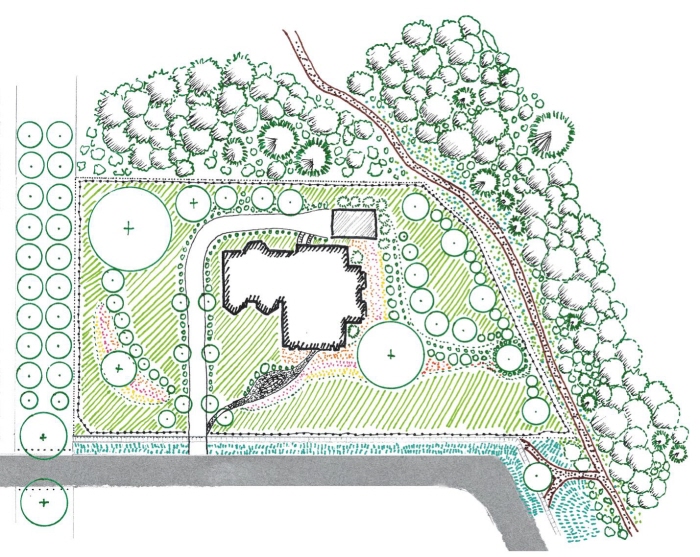
Hand rendering of an estate lot. These prestigious lots pay homage to the original affluent suburban homes on multi-acre properties. A forest trail runs along west of the property to allow the public to glimpse at the magnificent landscaped yard.
View PDF
View PDF
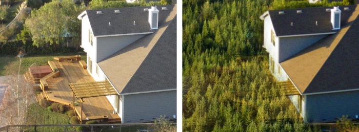
Replace backyards with forests as an alternative form of storm water management. This serves the senior population by reducing home purchasing price, chemical fertilizers, and the time/financial burden of lawn maintenance. Privatized backyards are now a public forest which serves the community with recreational and environmental benefits.
View PDF
View PDF
Forest Trails are laid throughout Mount Carmel to give multiple routes for users to explore. Widely accessible and extensive, the forest is planted in the amalgamated spaces of suburban backyards. Homeowners will have a backyard with clean cool air and the smell of forests all summer long.
View PDF
View PDF
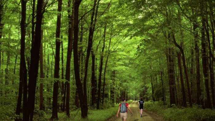
The Greenwalk is a major walking loop exclusively for pedestrians and bicyclists. It is extensively planted with shade trees, ornamental trees, and various vegetation to create an attractive choice to walk or bike to the local schools and shops.
View PDF
View PDF
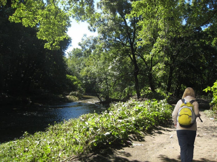
Creek Trail is a new opportunity for the community to explore the creek running through the suburb. It is a scenic trail that connects the community to Shriners Creek and witness wildlife springing forth from it.
View PDF
View PDF
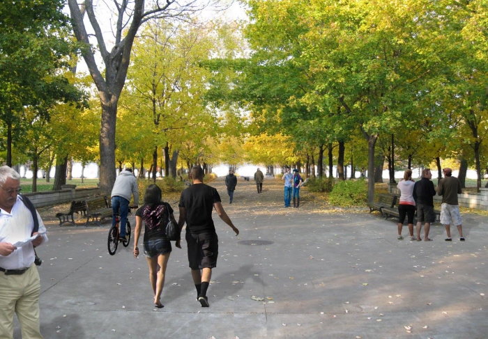
Suburban edge developments have failed to capitalize on the visual assets and natural wilderness, usually fences, homes, and/or sidewalks are erected. Mount Carmel Suburban Metamorphosis frames the inherent breathtaking views outward bound. Sunset Trail is a long and open concept path surrounded by farm fields on the edge of the suburban community. Experience the expansive landscape, fresh air, and unlimited skies from the comfort of the suburban realm.
View PDF
View PDF
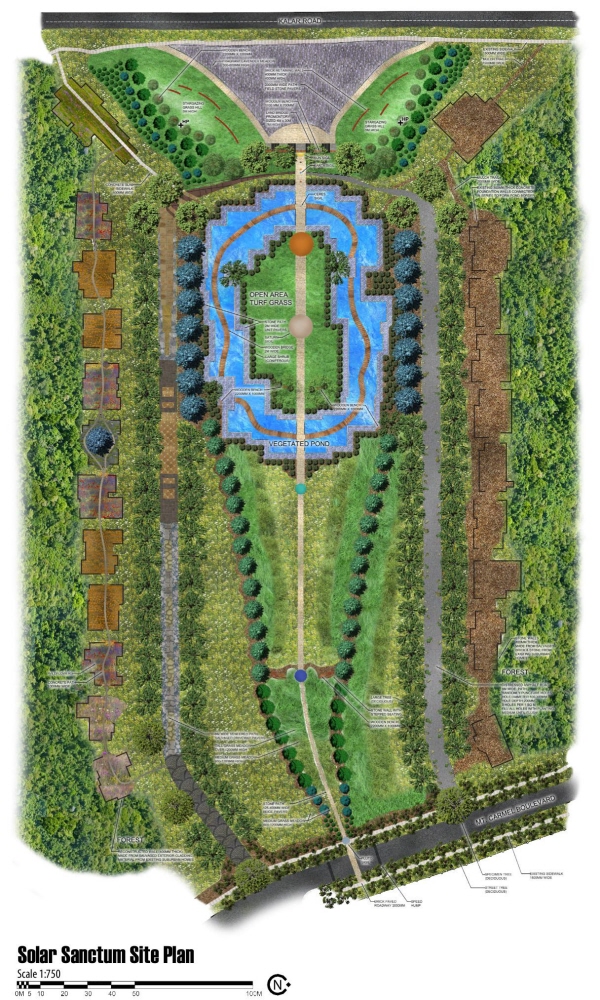
Park Concept: The beauty and enormity of time and space
Programming:
Sunset viewing, stargazing, passive recreation, pond activities, solar system education, picking wildflower, lavender sensory garden, cultural exploration and commentary on suburban sprawl movement.
Space Concept:
The narrow center ravine expanding in size represents space in the normal sense of volume, the expanded sense of outer space, and our control of it. The ravine expands to lead viewers down a narrow vista to landscape of the sunset, showing the enormity of space. Walking along the central ravine path is a scaled model of our solar system to add gravitas to the size of our solar system. There is a geometrically shaped manicured grassy to symbolize the human race controlling of space, which is done to a great extent.
View PDF
View PDF
Time Concept:
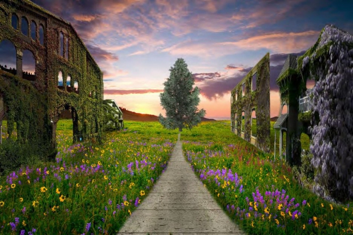
Vegetation overtakes the suburban ruins amidst wildflowers. The ruins consist of the reinforced exterior walls of the suburban homes that existed on site. Between the walls are wildflowers showing the beauty springing forth through the passage of time. Walking down the path represents is similar gives an x-ray view of the massive interiors of the suburban home.
These ruins in a way preserve the mistake, building footprints, scale, and land gluttony of suburban sprawl. The time concept is reinforced because the ruins show mankind's inability to control time and we are at the mercy of it. Meanwhile plant life, in the form of wildflowers and crawling wall vines, ultimately reclaims the land we have cleared away.
View PDF
View PDF
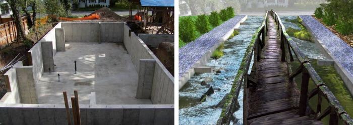
Creative reuse of the existing suburban homes and infrastructure are key to the metamorphosis. The concrete foundations of eight suburban homes are retrofitted in series to form a circular pond. The shape, stone paving, and water is modeled after the rocky asteroid belt and water representing the orbiting path. The wooden bridge allows user to walk the path of the asteroid belt in our solar system and look down into the flora and fauna of the pond.
View PDF
View PDF
Concept: The beautiful joining of Time and Space
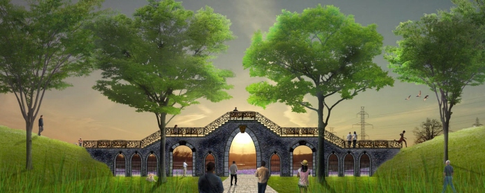
When the outer wildflower ruins (representing time) and the central expanding ravine (representing space) join at the apex of the site, users are greeted to a lookout bridge. The land bridge promontory overlooks the sunset to show the celestial body in space, the sun, slowly descending as time passes. It is the ideal location to witness the cascade of piercing oranges, waning pinks, and powdery blue skies.
View PDF
View PDF

Day & night view of the land bridge tunnel with luminescent starmap
View PDF
View PDF
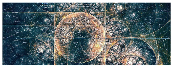
Illuminated starmap
View PDF
View PDF
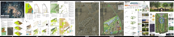
Full seven-panel layout
Each panel is 24 x 36 inches
View PDF
View PDF
gLike
Mount Carmel Suburban Metamorphosis
Mount Carmel Suburban Metamorphosis is prototype development that attempts to resolve suburban sprawl developments at the very edge of Niagara Falls, Ontario (Canada).