
Context Map - This image shows the relationship in size and distance to one another inside Cameron parish.
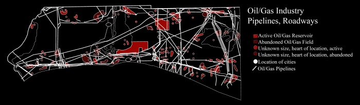
Oil/Gas Industry - Pipelines serve as an alley way for salt water from the Gulf while in some instances the roadways serve as a levee blocking off freshwater from replenishing the land
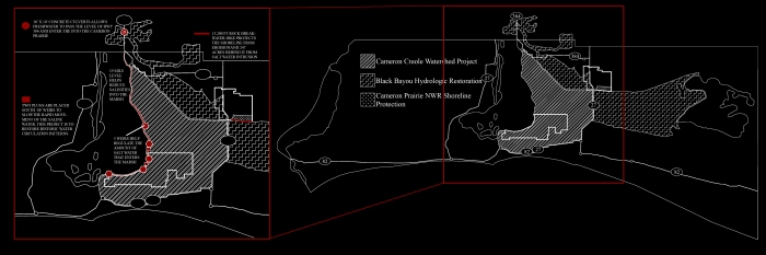
Project Boundary and Structure Diagram - The attempt to stop and restore marsh loss was unique in the two different areas. For the East Cove Unit, researchers developed plugs to re-route water let through by the water control structures set up on the levees. While the Cameron Prairie Unit put in culverts to allow freshwater in and built a simple but effective rock dike on its southern border to stop the shore from eroding.
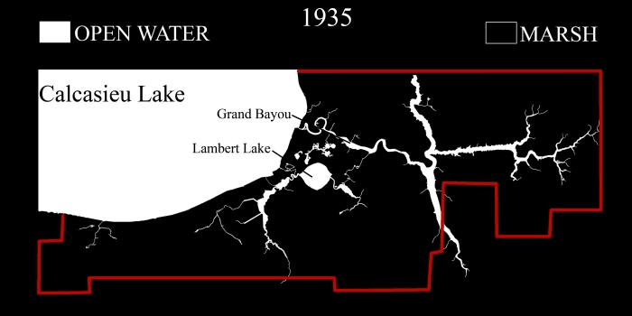
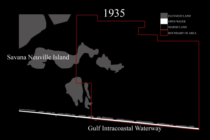
East Cove Unit water - marsh in 1935 - The difference in this image and the image from 1982 speaks volumes for the mismanagement of this piece of land.
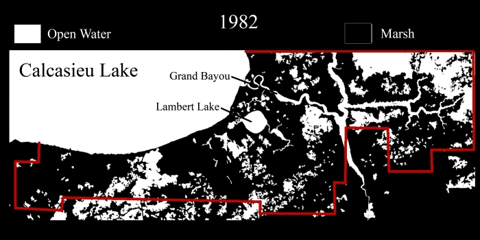
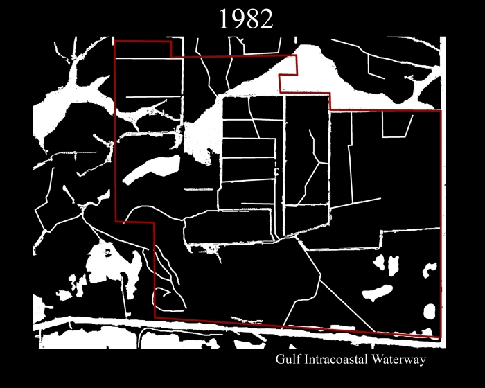
East Cove Unit _ 1982 - The open water into the marsh land is apparent and researchers start to investigate the causes.
Cameron Prairie National Wildlife Refuge - This area was all freshwater marsh with a few elevated areas, one recognized as an island.
Cameron Prairie NWR 1982 - Note the open water canals dug by the Oil and Gas Industry that read a open water on this diagram. Not long after this image was taken the restoration programs were implemented to stop the marsh loss.
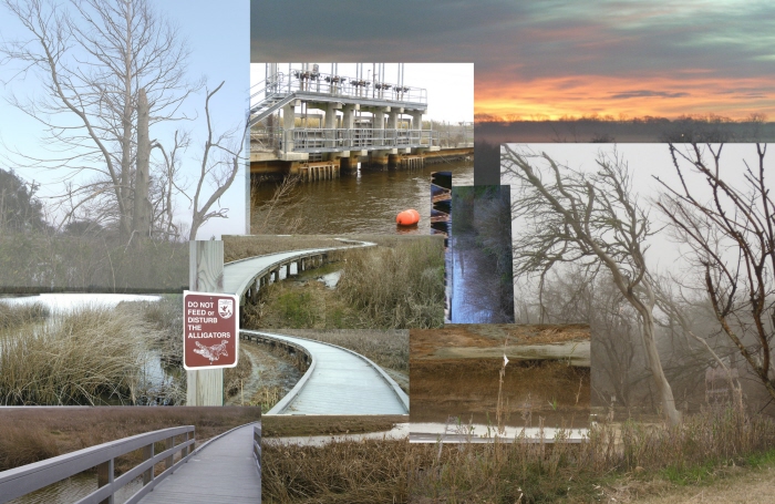
Photo Montage - East Cove Unit - Water Control Structure and plug
Model - Showing the water structures as positive restoration devices in the marsh.
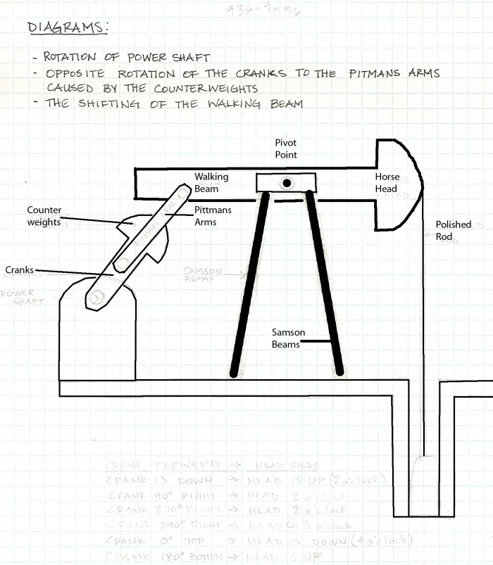
Sucker-Rod Pump - Shows parts
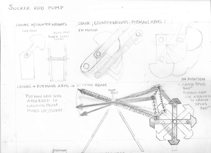
Cranks-Pittmans arms-walking beam - Shows the beginning movements of the machine, the cranks rotation and what follows.
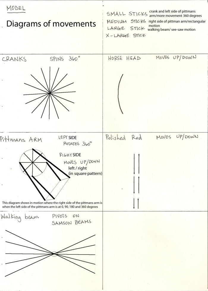
Diagram drawings for model - Movement of each part
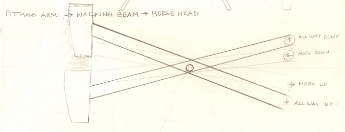
Walking beam-horse head - Shows movement of the horse head as the walking beam pivots
gLike
Jessica Roberts