
gLike
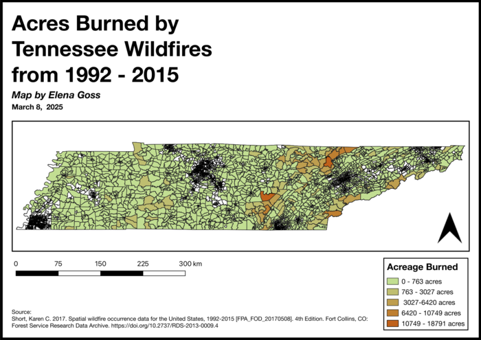
Acres Burned by Tennessee Wildfires 1992-2015
This map was created at the University of Tennessee as part of a GIS course focused on mapping environmental impacts. By visualizing the extent of burnt land from Tennessee wildfires, the map highlights regions at higher risk, informing efforts to predict and mitigate future wildfire events. This data-driven approach plays a crucial role in preserving human life and protecting Tennessee's diverse environments by guiding resource allocation, emergency planning, and land management strategies.