
gLike
Building Permit Application Distribution in Davidson County, Tennessee
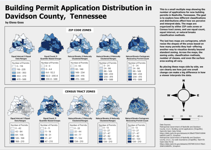
This map was also created in a geovisulation course at the University of Tennessee. This map represents the number of building permit applications across Davidson County, Tennessee, highlighting areas of high and low development activity. Using different classification methods, such as equal count, equal interval, and natural breaks, it provides insights into how development trends are distributed across the county. This visualization is valuable for policymakers, urban planners, economists, and anyone involved in zoning and development, as it helps assess growth patterns and inform future decisions on resource allocation and infrastructure planning.